Hurricane Ian

bigredfish

Known around here
Joined
Sep 5, 2016
Messages
17,409
Reaction score
48,573
Location
Floriduh
Busy day

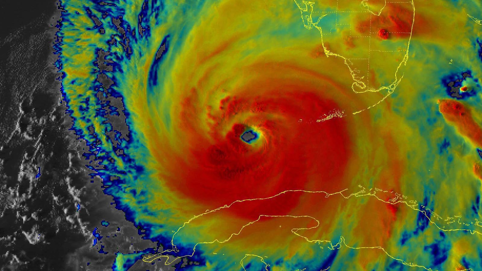
latest has it going in at Venice. The weather nerds say could be as far south as Cape Coral.

We’re in Tavares for reference. Lake county.
24 hours ago the eye was to come out of Tampa and skim us to our west in Sumter county.
12 hours ago it shifted east and was showing the eye passing right over top of us.
The latest run moved further East/South still and shows it passing now off to our east more or less Orlando.

5 pm update coming up but really at this point the models mean less than real time radar. Gonna be a nail biter..
 

bigredfish

Known around here
Joined
Sep 5, 2016
Messages
17,409
Reaction score
48,573
Location
Floriduh
FYI
NHC follows TVCN models as their go to bible

From the Stormtrack forum
Let's talk about the TVCN consensus model
Spaghetti plots. We have all seen them around social media and weather forums. So much data to take in, it all becomes a blur. But have you noticed the TVCN consensus model which is usually very close to what the NHC forecast is? How can it be so (relatively) accurate?

Let's dive into where the TVCN model gets it's data from.

1) The average of the last two runs of the members within the TCON plus the ECMWF model is known as the TVCN consensus.

2) The TCON consensus is the GUNA consensus plus the Hurricane WRF model.

3)The GUNA model is a consensus of the interpolated versions of the HMON, UKMET with quality control applied to the cyclone tracker, United States Navy NAVGEM, and GFS models.

So the TVCN involves the ECMWF, HWRF, HMON, UKMET, NAVGEM, and GFS.
 
Last edited:

fergenheimer

Getting comfortable
Joined
Oct 19, 2018
Messages
343
Reaction score
758
Location
SWTexas
Overnight in Fort Meade Florida 1/2" of rainfall and 10-20 mph winds that started late. Center of the cone of uncertainty was directly overhead. It still looks like it's on the same track. Just stronger.
 

Flintstone61

Known around here
Joined
Feb 4, 2020
Messages
6,610
Reaction score
10,939
Location
Minnesota USA

bigredfish

Known around here
Joined
Sep 5, 2016
Messages
17,409
Reaction score
48,573
Location
Floriduh
Just starting to get some heavier rain and outer feeder bands in central FL. Conditions will get uglier as the day goes on. First the tornados, lots of rain, later towards dinner we’ll start seeing “ Holy Shit” winds throughout the night and tomorrow

Worst for us will be late afternoon today through sunset Thursday.

Will try to keep you updated. Lots still to do as I have to finish packing go bags for mom and truck loaded and get things ready to leave unexpectedly if need be.
 
Top